GeoSpy feels like the ultimate power-up for anyone who’s ever played GeoGuessr and wished for an AI edge. Instead of relying purely on intuition and obscure clues, you have an AI at your side, pinpointing locations from just an image.
What is GeoSpy?
GeoSpy is an AI-powered tool designed to analyze images and determine their geographic location with impressive accuracy. By utilizing advanced machine learning models, GeoSpy can extract visual clues from photos—such as architectural styles, landscapes, and street signs—and cross-reference them with vast geographic databases to pinpoint the exact or approximate location where the image was taken. This tool is particularly useful for enthusiasts of location-based games, researchers, photographers, and even marketers who need to gather location-specific data quickly and efficiently.
Unlike traditional geolocation tools, GeoSpy simplifies the process by allowing users to upload an image and receive location data without needing GPS metadata or additional details. Its ease of use and AI-driven capabilities make it a powerful option for those looking to explore new possibilities in geolocation technology, from playful applications like GeoGuessr to more professional uses like location verification or content analysis.
Wouldn’t you like artificial intelligence to be your dog’s personal translator?
How to use GeoSpy?
Using the tool is straightforward, and its intuitive interface makes it simple to get started.
Here’s a step-by-step guide based on our experience:
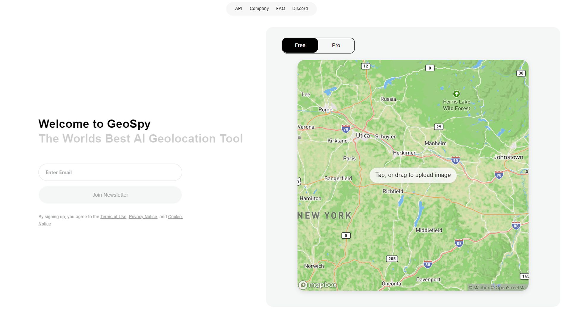
- Access the website: Start by visiting the GeoSpy website, where you’ll be greeted with an option to upload an image directly from your device. GeoSpy supports a variety of image formats, so any high-quality photo will work.

- Upload your image: We used a random photo from Unsplash, a popular source for high-resolution images, to put the tool to the test. Simply drag the photo to the upload area, or click to browse your files.

- Wait for the analysis: Once the photo is uploaded, GeoSpy’s AI takes over. The tool starts analyzing the visual elements within the image, comparing architectural styles, landscapes, or other identifiable features. This process typically takes a few seconds.

- Review the results: After the analysis, GeoSpy displays the approximate location on a detailed map. In our case, the image we uploaded from Unsplash was identified as being in New York City.

About GeoSpy Pro
There’s also a Pro version of GeoSpy for specific purposes. It’s designed to go beyond what the human eye can see, identifying subtle patterns and features that allow it to pinpoint locations with remarkable accuracy. Whether it’s a seemingly nondescript street or a remote place, GeoSpy Pro claimed to be able to analyze visual data and provide precise location insights.
GeoSpy Pro is tailored for professionals who require advanced geolocation capabilities. Law enforcement agencies, government bodies, journalists, and investigators can leverage its powerful tools to aid in their work, whether it’s tracking criminal activity, verifying location data, or conducting investigative research. It’s a sophisticated solution for those who need to work with location-based information on a deeper level, with accuracy and reliability.
It’s kinda creepy
While GeoSpy’s capabilities are undeniably impressive, the ethical implications surrounding such powerful AI technology deserve serious consideration.
Who should have access to this kind of technology? In the hands of law enforcement and journalists, it can be a force for good—helping solve crimes, verify facts, and gather critical information. But in less regulated environments, the potential for misuse becomes apparent.
Should there be limitations on its use to protect individual privacy, or do the benefits outweigh these concerns?
Featured image credit: Kerem Gülen/Midjourney


